
City guide · Tri-Cities & Northeast
Pitt Meadows city guide
Dike trails, berry farms and marshland under big mountain skies, in a small city where the Pitt River meets the Fraser.
01 At a glance
Welcome to Pitt Meadows
Pitt Meadows is a small, friendly city on the flat floodplain between the Pitt and Fraser rivers, known for its farms, dike trails and wild marshes leading up to Pitt Lake. It suits cyclists, birdwatchers and families who want a quiet, small-town base with commuter rail into Vancouver.
- Vibe
- Rural, open, small-town
- Best for
- Dike rides, birdwatching and farm country
- Getting around
- West Coast Express & R3 Lougheed RapidBus
Pitt Meadows at a glance
Pitt Meadows is a small city of farms, dikes and big skies on the floodplain where the Pitt River meets the Fraser. It sits between Port Coquitlam across the Pitt River to the west and Maple Ridge to the east, and most of its land is flat farmland, wetlands and protected marsh, with the mountains of the Coast Range rising sharply to the north.
The town centre is compact and grouped around Harris Road and Lougheed Highway, with City Hall, the recreation centre, an art gallery, shops and the West Coast Express station all close together. Residential neighbourhoods spread out from there, including the riverside Osprey Village area near the Pitt River and the newer streets in the south, while the northern part of the city is almost entirely agricultural.
The 2021 Census counted 19,146 residents, making Pitt Meadows one of the smaller cities in Metro Vancouver. It has a close-knit, small-town feel and appeals to families, cyclists, birdwatchers and anyone who likes wide-open views. Blueberry and cranberry fields, horse farms and long, straight country roads are a big part of its identity. For visitors, it is a place to slow down, get on a bike and enjoy some of the widest open views anywhere in Metro Vancouver.
A short history
Pitt Meadows lies within the traditional territory of the Katzie First Nation, whose people have lived for thousands of years along the Pitt River, Pitt Lake and the Fraser, fishing, hunting and gathering in the rich marshlands. Katzie community lands remain in the area today, and the city’s crest includes a Katzie eagle symbol in recognition of the original inhabitants.
European settlement began in the 1870s, when a river landing known as Bonson’s Landing was established. The city takes its name from the Pitt River and Pitt Lake. Because so much of the land sat at or near river level, early farmers organized a dyking district in 1893, and dikes, ditches and pump stations have protected the community ever since. French Canadian and Japanese settlers arrived after 1910, and the District of Pitt Meadows was incorporated in 1914.
After the Second World War, Dutch farmers reclaimed and worked much of the low-lying land, building the agricultural base that still defines the north of the city. Pitt Meadows Regional Airport opened in 1963. The community joined the regional district in 1995 and officially became a city on 1 January 2007. The opening of the new Pitt River Bridge and the Golden Ears Bridge in 2009 greatly improved connections to the rest of the region.
Top things to do in Pitt Meadows
Dikes, marshes and Pitt Lake
- Dike trails: Pitt Meadows is ringed by dikes, and the trails on top of them make long, flat routes for walking, running and cycling, with mountain views in every direction. The routes along the Pitt and Alouette rivers are especially popular.
- Pitt-Addington Marsh and Grant Narrows: at the north end of the valley, Grant Narrows is the gateway to Pitt Lake and to the provincially managed Pitt-Addington Marsh Wildlife Management Area. It is known for birdwatching, canoeing and kayaking, and for views up the lake into the mountains. The gate is usually open from dawn to dusk; check for maintenance closures before you go.
- Pitt Lake: a large tidal freshwater lake stretching north into the Coast Mountains. Paddlers should be prepared for wind and changing conditions.
Farm country
- Berry farms and farm stands: in summer, roadside stands and farms sell blueberries and other local produce. The cranberry harvest in autumn, when the fields are flooded, is a striking sight from the road.
- Country roads by bike: the flat farm roads in the north of the city are popular with road cyclists, though you should watch for farm vehicles and keep to the shoulder.
Town centre and community
- Pitt Meadows Art Gallery: a small community gallery in the town centre showing local and regional artists.
- Pitt Meadows Museum: the local heritage society’s museum and historic buildings share stories of the city’s farming and settlement history.
- Pitt Meadows Regional Airport: a busy general aviation airport where you can watch small planes and helicopters, and home to flight training and skydiving operators.
A day on the dikes
Pitt Meadows is best seen slowly. Park or arrive by train near the town centre, pick up coffee on Harris Road, then head out by bike along the dikes toward the Pitt River. Follow the water north past farms and marshland, where herons, eagles and ducks are common sightings, and make your way toward Grant Narrows for a picnic with views up Pitt Lake. In summer, stop at a farm stand on the way back for a basket of blueberries. A full loop is long, so check a map, carry water and allow plenty of time; many visitors ride just one section and turn back.
If you would rather be on the water, rent a canoe or kayak at Grant Narrows and paddle into the quiet channels at the edge of the marsh, keeping an eye on the wind on the open lake.
Golf and recreation
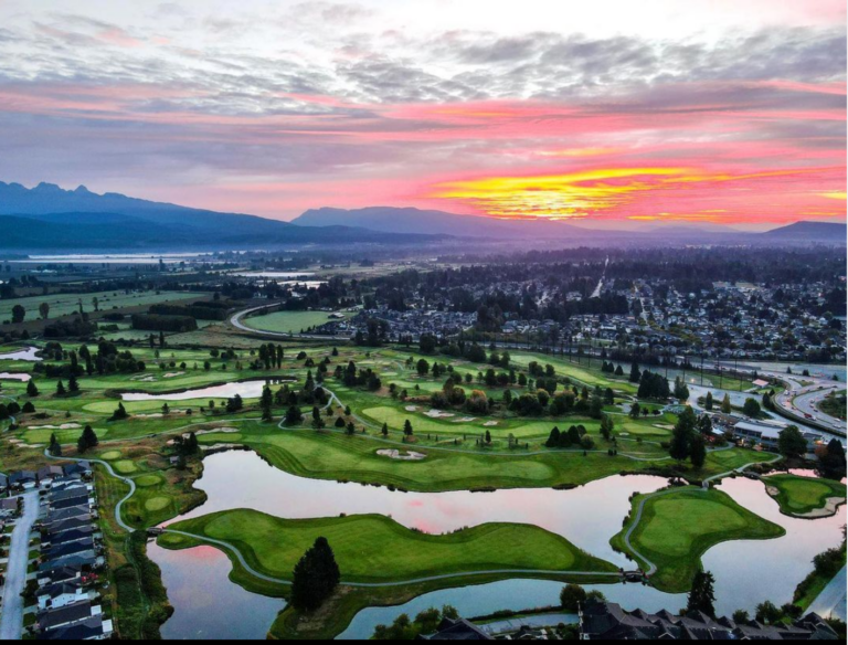
Pitt Meadows has several golf courses set against mountain backdrops, along with sports fields, the Pitt Meadows Family Recreation Centre and the South Bonson Community Centre. Pitt Meadows Athletic Park is the city’s main venue for outdoor sports and large community events.
Food and drink
Pitt Meadows has a modest, local dining scene. Most restaurants, cafés and pubs are in the town centre along Harris Road and Lougheed Highway, in the Meadowtown shopping area and in the commercial area around Osprey Village. Expect casual family restaurants, coffee shops and takeout rather than destination dining.
Where Pitt Meadows really shines is fresh local produce. In summer, farm stands sell berries straight from the fields, and many residents shop at markets and farm gates for vegetables, eggs and preserves. For a wider choice of restaurants, neighbouring downtown Maple Ridge and Port Coquitlam are a short drive away.
A good plan for a day out is to pack a picnic. Many of the best spots in Pitt Meadows, from the dikes to Grant Narrows, have no food service at all, so stock up in the town centre before you head north into the farmland.
Where to stay
Pitt Meadows has very little visitor accommodation, so most travellers stay in neighbouring Maple Ridge, Port Coquitlam or Coquitlam and visit for the day. If you do stay in Pitt Meadows, the town centre is the most convenient area, close to the West Coast Express, the R3 RapidBus and shops.
For outdoor-focused trips, staying in Maple Ridge puts you between Pitt Meadows’ dikes and Golden Ears Provincial Park. Visitors who prefer a quieter rural stay can look for guest suites and farm stays in the surrounding countryside, though you will need a car.
Getting around
West Coast Express: Pitt Meadows station, on Harris Road near the town centre, is a stop on TransLink’s commuter rail line between Mission and Waterfront Station in downtown Vancouver. Trains run on weekdays only: five in the morning toward Vancouver and five in the afternoon and evening back toward Mission. Maple Meadows station, just across the boundary in Maple Ridge, is also close to parts of Pitt Meadows.
RapidBus and buses: the R3 Lougheed Hwy RapidBus stops in Pitt Meadows, including at Harris Road, on its route between Coquitlam Central Station and Haney Place in Maple Ridge. At Coquitlam Central you can connect to the Millennium Line SkyTrain and the West Coast Express. Local buses link the station area with Meadowtown and other neighbourhoods.
Driving: Lougheed Highway (Highway 7) crosses the city and the Pitt River Bridge into Port Coquitlam. The Golden Ears Bridge crosses the Fraser River to Langley and Surrey, reached via Golden Ears Way. Both make Pitt Meadows a convenient crossroads, though Lougheed Highway gets busy at rush hour.
Cycling: thanks to its flat terrain and dike network, Pitt Meadows is one of the easiest places in the region to explore by bike. Bring water and sun protection in summer, as there is little shade along the dikes.
Seasons and events
Pitt Meadows has a mild, wet coastal climate. Because it is open and flat, wind can be strong along the dikes and at Pitt Lake, and fog sometimes settles over the fields on autumn and winter mornings. Spring and autumn are excellent for birdwatching in the marshes, summer is berry season and the best time for paddling, and the cranberry harvest colours the fields red in autumn.
- Pitt Meadows Day: the city’s signature community celebration, held each June with a parade along Harris Road and festivities at Pitt Meadows Athletic Park. In 2026 it took place on 6 June.
- Maple Ridge Pitt Meadows Country Fest: the long-running summer agricultural fair shared with Maple Ridge and held at the Albion Fairgrounds. The 2026 fair ran from 24 to 26 July.
- Birding seasons: spring and autumn migration bring large numbers of waterfowl and songbirds to the marshes around Grant Narrows.
Living in Pitt Meadows
Housing in Pitt Meadows is a mix of detached homes, townhouses and low-rise apartments in the neighbourhoods near the town centre and along the river, plus farms and acreages in the agricultural north. Much of the land is in the Agricultural Land Reserve, which limits new subdivision and helps keep the city small and green.
Public schools are run by School District 42 (Maple Ridge–Pitt Meadows), which the city shares with Maple Ridge. The two communities also share Ridge Meadows Hospital and many sports leagues and community groups. Post-secondary options are in neighbouring Coquitlam, Langley and Surrey.
The neighbourhoods each have a slightly different feel. Central Pitt Meadows, around Harris Road, is the most walkable, close to the station, shops and recreation centre. South Pitt Meadows and the Osprey Village area near the Pitt River have newer homes and townhouses with quick access to Lougheed Highway and the Golden Ears Bridge. North of the town centre, homes give way to farms, nurseries and acreages along long rural roads, where the pace is slow and the views stretch to the mountains.
Pitt Meadows suits people who want a quiet, small-town lifestyle with farmland and trails at the end of the street, while still having commuter rail and a RapidBus into the wider region. It is popular with families, cyclists and active retirees.
Practical notes: most households rely on a car, though the town centre is compact and walkable. Because the city lies on a floodplain, the dike system is an important part of local infrastructure, and residents should know the city’s emergency information for high-water seasons. Commuters heading west should allow for traffic on Lougheed Highway and the Pitt River Bridge, or use the West Coast Express on weekdays.
03 Don’t miss
Top things to do in Pitt Meadows
- 01
Dike trails
Long, flat walking and cycling routes along the Pitt and Alouette rivers with mountain views.
- 02
Grant Narrows and Pitt Lake
Gateway to Pitt Lake for paddling, birding and big mountain scenery.
- 03
Pitt-Addington Marsh
Provincially managed wildlife area known for waterfowl and migrating birds.
- 04
Berry country
Summer blueberries at farm stands and flooded red cranberry fields at harvest time.
- 05
Pitt Meadows Day
The city's June parade and community festival at Pitt Meadows Athletic Park.
- 06
Pitt Meadows Regional Airport
General aviation airport with flight training and skydiving.
- 07
Town centre
Compact Harris Road hub with an art gallery, recreation centre and the train station.
04 Neighbourhoods
Explore Pitt Meadows neighbourhood by neighbourhood
On the map
Around Pitt Meadows
Pitt Meadows station on Harris Road is a weekday stop on the West Coast Express, with morning trains to Waterfront Station in downtown Vancouver and evening trains back. The R3 Lougheed Hwy RapidBus runs through the city between Coquitlam Central Station and Haney Place, and the Pitt River and Golden Ears bridges connect drivers to Port Coquitlam, Langley and Surrey.
 Waves Coffee House - Pitt MeadowsCafeView →
- 7-Eleven - Pitt MeadowsGroceryView →
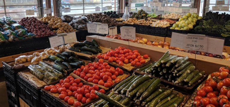
- Langley Farm Market - Pitt MeadowsGroceryView →
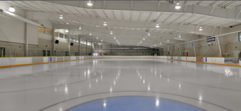
- Pitt Meadows Arena ComplexGym and fitnessView →
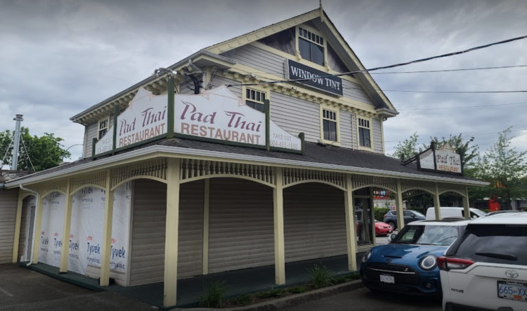
- Pad Thai RestaurantRestaurantView →
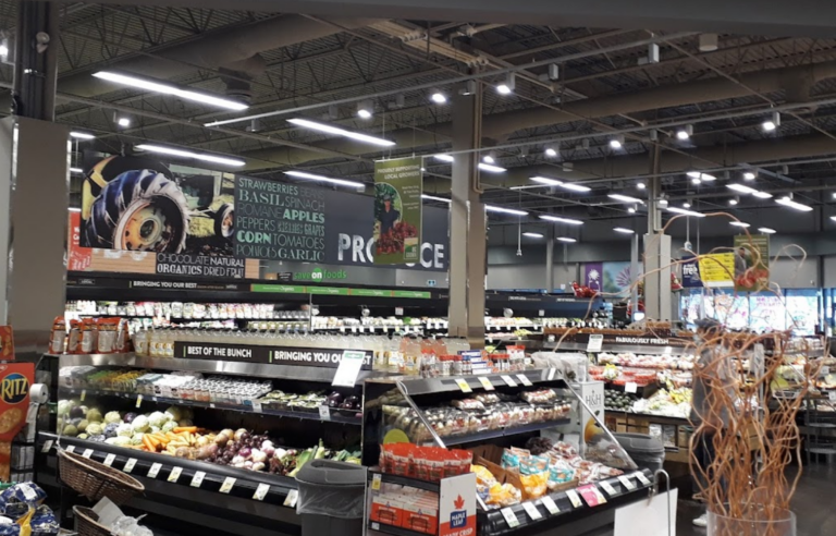
- Save-On-Foods - Pitt MeadowsGroceryView →
- Shoppers Drug Mart - Pitt MeadowsGroceryView →
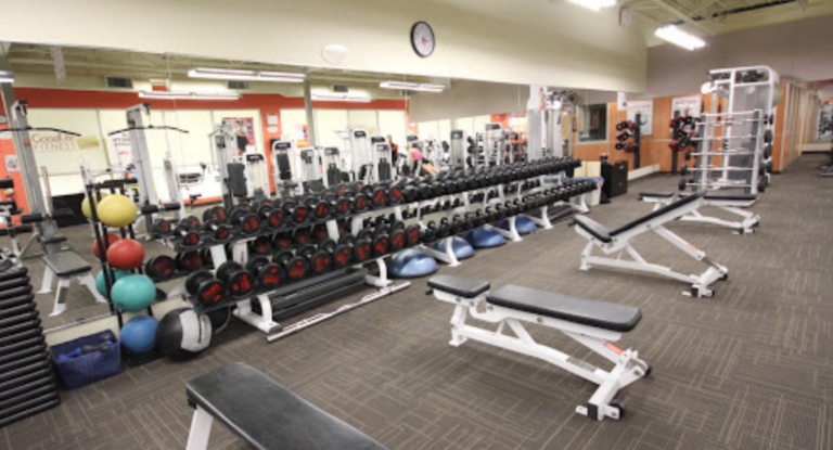
- Anytime Fitness - Pitt MeadowsGym and fitnessView →
- Pizza Pizza - Pitt MeadowsRestaurantView →
- Cineplex Odeon Meadowtown CinemasCinemaView →
- Sango Sushi Pitt MeadowsRestaurantView →
- Blenz Coffee - Pitt MeadowsCafeView →
- Fit4Less - Pitt MeadowsGym and fitnessView →
- Tim Hortons - Pitt MeadowsBakeryView →
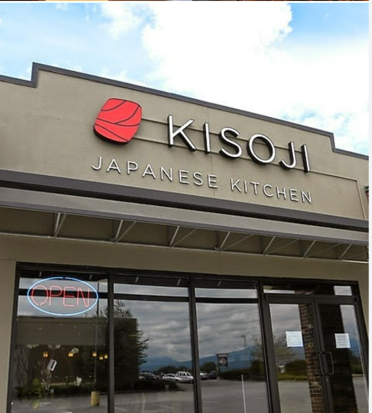
- Kisoji Japanese KitchenRestaurantView →
- Meadow Gardens Golf ClubGolf CoursesView →
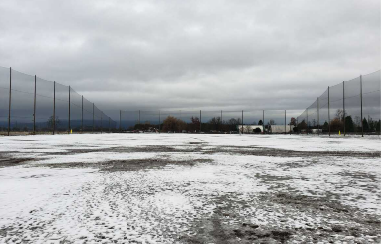
- Meadows Golf Centre - Pitt MeadowsGolf CoursesView →









Refresh & refuel
Where to eat & drink in Pitt Meadows
 0.2 kmWaves Coffee House - Pitt MeadowsCafe12099 Harris Rd #106, Pitt Meadows, BC V3Y 0E5, Canada
- 1.1 kmPad Thai RestaurantRestaurant12540 Harris Road unit 102, Pitt Meadows, BC V3Y 2J4, Canada
- 1.2 kmPizza Pizza - Pitt MeadowsRestaurant19150 Lougheed Hwy., Pitt Meadows, BC V3Y 2H6, Canada
- 1.3 kmSango Sushi Pitt MeadowsRestaurant19800 Lougheed Hwy. #350, Pitt Meadows, BC V3Y 2W1, Canada
- 1.3 kmBlenz Coffee - Pitt MeadowsCafe19800 Lougheed Hwy. #310, Pitt Meadows, BC V3Y 2W1, Canada
- 1.3 kmTim Hortons - Pitt MeadowsBakery19800 Lougheed Hwy., Pitt Meadows, BC V3Y 2W1, Canada
- 1.3 kmKisoji Japanese KitchenRestaurant19040 Lougheed Hwy., Pitt Meadows, BC V3Y 2J2, Canada
Own a business in Pitt Meadows?
Get discovered by locals and visitors planning their time in the city.
FAQ
Pitt Meadows: good to know
How do I get to Pitt Meadows from downtown Vancouver?
On weekdays, take the West Coast Express from Waterfront Station to Pitt Meadows station (afternoon and evening departures). At other times, take the Millennium Line to Coquitlam Central and transfer to the R3 Lougheed Hwy RapidBus. By car, follow Highway 1 and Lougheed Highway east over the Pitt River Bridge.
How far is Pitt Meadows from YVR?
It is on the opposite side of the region from the airport. Drivers usually use Highway 1 or the Golden Ears Bridge route; by transit, combine the Canada Line, SkyTrain to Coquitlam Central and the R3 RapidBus.
Where is the best place to see Pitt Lake?
Grant Narrows, at the north end of the valley, is the main access point for viewing and paddling. The gate is typically open dawn to dusk, but check the City of Pitt Meadows website for closures.
When is the best time to visit?
Summer for berry season, paddling and long dike rides; spring and autumn for birdwatching; and autumn to see the cranberry harvest.
Is Pitt Meadows good for families?
Yes. Flat, safe dike trails are great for kids on bikes, and the city has parks, a recreation centre and the family-friendly Pitt Meadows Day each June.
Is Pitt Meadows part of Maple Ridge?
No. Pitt Meadows is a separate city just west of Maple Ridge, though the two share a school district, a hospital and many community events.
Sources for the facts on this page
- Statistics Canada, 2021 Census of Population: Pitt Meadows (CY), population 19,146
- Statistics Canada 2021 Census land area for Pitt Meadows (CY), 86.34 km², as given in the Wikipedia article 'Pitt Meadows'
- Read the Ridge, 'Maple Ridge voters oust mayor ... Pitt Meadows re-elects MacDonald' (20 Oct 2026)
- Global News, 'B.C. municipal election 2026: latest updates, polls and results' (Oct 2026)
- Daily Hive, 'The ultimate list of Metro Vancouver mayoral winners in the 2026 civic election' (18 Oct 2026)
- City of Pitt Meadows, 'Road and Facility Closures for Pitt Meadows Day (June 6)' (2026)
- City of Pitt Meadows, 'Pitt-Addington Marsh/Grant Narrows' park page
- TransLink, West Coast Express schedules; Wikipedia, 'Pitt Meadows station' and 'R3 Lougheed Hwy'
- Maple Ridge Pitt Meadows Country Fest, 'Albion Fairgrounds, July 24 - 26, 2026'
- Wikipedia, 'Pitt Meadows' (history: Bonson's Landing, 1893 dyking district, 1914 incorporation, 2007 city status, 1963 airport, 2009 bridges)
Keep exploring
Nearby city guides
- Tri-Cities & Northeast · 6.7 kmMaple RidgeA Fraser River city at the foot of the Golden Ears, with lakes, dike…
- Tri-Cities & Northeast · 8.1 kmPort CoquitlamTerry Fox's hometown: a friendly river city ringed by a 25 km trail, a…
- South of the Fraser · 9.8 kmLangley TownshipHeritage Fort Langley, farm country, wineries and horse trails, plus fast-growing suburbs from Willoughby…
- Tri-Cities & Northeast · 10.2 kmCoquitlamLakes, forest trails and mountain views meet a SkyTrain-served city centre, Korean and Persian…
- South of the Fraser · 12.1 kmSurreyBC's second-largest city: six town centres, big parks, Punjabi food, farm country and a…
- Tri-Cities & Northeast · 12.4 kmPort MoodyA small city at the head of Burrard Inlet, with shoreline trails, paddling, railway…