- Home
- Businesses
- Events
- All Upcoming Events
- Vancouver Events Calendar 2026
- January 2026 Events Calendar in Vancouver
- February 2026 Events Calendar in Vancouver
- March 2026 Events Calendar in Vancouver
- April 2026 Events Calendar in Vancouver
- May 2026 Events Calendar in Vancouver
- June 2026 Events Calendar in Vancouver
- July 2026 Events Calendar in Vancouver
- August 2026 Events Calendar in Vancouver
- September 2026 Events Calendar in Vancouver
- October 2026 Events Calendar in Vancouver
- November 2026 Events Calendar in Vancouver
- December 2026 Events Calendar in Vancouver
- Best Pumpkin Patches Near Vancouver
- Canada Day 2026 Events
- FIFA World Cup 2026 Vancouver Guide
- Nowruz 1405 (Year 2585) in Vancouver: Persian New Year Guide
- Holi Festivals 2026 Guide
- Lunar New Year 2026 Guide
- Polar Bear & Penguin Plunges 2026
- Christmas Events Vancouver 2026
- Remembrance Day 2026
- Halloween Fireworks 2026
- Diwali Fest 2026 Events Guide
- Spirit Halloween Stores 2026 Guide
- Vancouver’s Oktoberfest 2026 Guide
- Attractions
- Things to Do
- Metro Vancouver
- City of Vancouver
- City of Surrey
- City of Burnaby
- City of Richmond
- City of Coquitlam
- City of North Vancouver
- West Vancouver
- City of Langley
- Township of Langley
- Fort Langley
- City of Delta
- City of Maple Ridge
- City of New Westminster
- City of White Rock
- City of Port Coquitlam
- City of Port Moody
- City of Pitt Meadows
- Tsawwassen
- City of Abbotsford
- City of Chilliwack
- Squamish
- Whistler
- Guide
- prev
- next
- Leave a review
- Claim listing
- Bookmark
- Share
- Report
- prev
- next
Ads
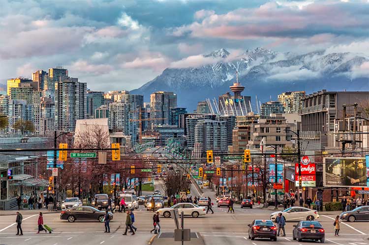
Metro Vancouver and the Lower Mainland are home to about three million people in the southwest corner of British Columbia, stretching from the Pacific coast and the North Shore Mountains east along the Fraser River valley. The region is made up of more than twenty cities, towns and First Nations, each with its own character: dense downtown neighbourhoods, quiet suburbs, historic villages, farms, beaches, ski hills and mountain towns. This guide explains how the region fits together and links to our complete guide for each city and community.
The region sits on the traditional, ancestral and unceded territories of many Coast Salish peoples, including the xʷməθkʷəy̓əm (Musqueam), Sḵwx̱wú7mesh (Squamish), səlilwətaɬ (Tsleil-Waututh), Stó:lō, Kwantlen, Katzie, Kwikwetlem, Semiahmoo, Tsawwassen and Qayqayt Nations, and the Lil'wat Nation in the Sea to Sky corridor.
Metro Vancouver and the Lower Mainland at a Glance
| Fact | Detail |
|---|---|
| Province | British Columbia, Canada |
| Metro Vancouver population (2021 census) | 2,642,825; close to 3 million today |
| Lower Mainland population | About 3 million, including the Fraser Valley |
| Metro Vancouver members | 21 municipalities, 1 electoral area and 1 treaty First Nation |
| Largest city | Vancouver (662,248 in 2021); Surrey is expected to overtake it within a decade |
| Regional government | Metro Vancouver Regional District, headquartered in Burnaby |
| Regional transit | TransLink in Metro Vancouver; BC Transit in the Fraser Valley and Sea to Sky |
| Main airport | Vancouver International Airport (YVR), Richmond |
| Time zone | Pacific Time (UTC−8; UTC−7 in summer) |
| Area codes | 604, 778, 236, 672 |
| Next local elections | Saturday, October 17, 2026, in every municipality |
Find Your City or Community
Choose a city or community below to open its complete guide, covering history, neighbourhoods, things to do, parks, transit, schools, government, events and more.
Metro Vancouver cities
| City | Population (2021) | Known for |
|---|---|---|
| City of Vancouver | 662,248 | Stanley Park, downtown, beaches and Canada's most diverse big city |
| City of Surrey | 568,322 | BC's fastest-growing city, Vaisakhi, Crescent Beach and Cloverdale |
| City of Burnaby | 249,125 | Metrotown, SFU, Burnaby Mountain and Deer Lake |
| City of Richmond | 209,937 | YVR, Steveston, the Night Market and Asian food |
| City of Coquitlam | 148,625 | Lafarge Lake, Koreatown, Maillardville and forest trails |
| Township of Langley | 132,603 | Farms, wineries, Willoughby and Fort Langley |
| City of Delta | 108,455 | Ladner, Tsawwassen, North Delta, birds and Burns Bog |
| City of Maple Ridge | 90,990 | Golden Ears Provincial Park and Alouette Lake |
| City of New Westminster | 78,916 | The Royal City, BC's first capital, and the riverfront Quay |
| City of Port Coquitlam | 61,498 | Terry Fox's hometown and the Traboulay PoCo Trail |
| City of North Vancouver | 58,120 | The Shipyards, Lonsdale Quay and the SeaBus |
| West Vancouver | 44,122 | The Seawalk, Lighthouse Park, Cypress and Horseshoe Bay |
| City of Port Moody | 33,535 | Rocky Point Park, Brewers Row and the City of the Arts |
| City of Langley | 28,963 | Walkable downtown and the future SkyTrain terminus |
| City of White Rock | 21,939 | The pier, the white rock and seaside dining |
| City of Pitt Meadows | 19,146 | Pitt Lake, marshes, dike trails and berry farms |
Communities and villages
| Community | Part of | Known for |
|---|---|---|
| Fort Langley | Township of Langley | The birthplace of British Columbia and a heritage village main street |
| Tsawwassen | City of Delta | Sunshine, Centennial Beach, the ferry terminal and Point Roberts |
Fraser Valley
| City | Population (2021) | Known for |
|---|---|---|
| City of Abbotsford | 153,524 | The Airshow, farms, Sikh heritage and Mount Baker views |
| City of Chilliwack | 93,203 | Cultus Lake, Bridal Veil Falls, rivers and sweet corn |
Sea to Sky corridor
| Town | Population (2021) | Known for |
|---|---|---|
| Squamish | 23,819 | The Stawamus Chief, Sea to Sky Gondola, climbing and eagles |
| Whistler | 13,982 | Whistler Blackcomb, the Peak 2 Peak Gondola and the bike park |
Coming soon
Guides for the District of North Vancouver, the Village of Anmore, the Village of Belcarra, Bowen Island, the Village of Lions Bay, Electoral Area A (including UBC) and the Tsawwassen First Nation are on the way.
Metro Vancouver vs. the Lower Mainland: What's the Difference?
The names are often used interchangeably, but they mean different things.
Metro Vancouver is the official regional district made up of 21 municipalities, one electoral area (including the UBC and University Endowment Lands area) and the Tsawwassen First Nation. It is also the name commonly used for the urban region around Vancouver. People sometimes call it "Greater Vancouver," its former official name.
The Lower Mainland is a broader geographic term for the southwestern corner of mainland BC. It usually includes Metro Vancouver plus the Fraser Valley Regional District, with cities such as Abbotsford, Chilliwack, Mission and Hope. It does not officially include the Sea to Sky corridor, although Squamish and Whistler are closely tied to the region and often visited together.
| Area | Includes | Regional government |
|---|---|---|
| Metro Vancouver | Vancouver, Surrey, Burnaby, Richmond, Coquitlam, the Langleys, Delta, the North Shore and more | Metro Vancouver Regional District |
| Fraser Valley | Abbotsford, Chilliwack, Mission, Kent, Harrison Hot Springs, Hope and rural areas | Fraser Valley Regional District |
| Sea to Sky corridor | Squamish, Whistler, Pemberton and rural areas | Squamish-Lillooet Regional District |
All Metro Vancouver Municipalities
Metro Vancouver's members are:
| Municipality | Type |
|---|---|
| Vancouver | City |
| Surrey | City |
| Burnaby | City |
| Richmond | City |
| Coquitlam | City |
| Langley (Township) | Township |
| Delta | City |
| North Vancouver (District) | District |
| Maple Ridge | City |
| New Westminster | City |
| Port Coquitlam | City |
| North Vancouver (City) | City |
| West Vancouver | District |
| Port Moody | City |
| Langley (City) | City |
| White Rock | City |
| Pitt Meadows | City |
| Bowen Island | Island municipality |
| Anmore | Village |
| Lions Bay | Village |
| Belcarra | Village |
| Electoral Area A (UBC, University Endowment Lands and rural areas) | Electoral area |
| Tsawwassen First Nation | Treaty First Nation |
Geography of the Region
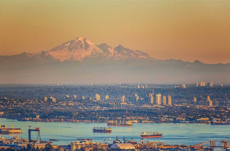
Metro Vancouver sits on the delta and lowlands of the Fraser River, between the Coast Mountains to the north and the US border to the south. Burrard Inlet and the North Shore Mountains frame the north side of the region, while the Fraser River divides it into north and south. East of Metro Vancouver, the Fraser Valley widens into rich farmland ringed by mountains, including Mount Baker in Washington State. North of Vancouver, the Sea-to-Sky Highway follows Howe Sound to Squamish and climbs into the mountains to Whistler.
Climate
The region has a mild oceanic climate, among the warmest in Canada in winter. Coastal areas such as Vancouver, Richmond, Delta and White Rock are mild year-round, with wet winters and dry, sunny summers. Rain increases sharply toward the North Shore Mountains, the Fraser Valley has hotter summers and colder winters, and Whistler gets heavy snow. Tsawwassen and White Rock are the sunniest and driest places in the region.
Indigenous Peoples of the Region
The Lower Mainland has been home to Coast Salish peoples for thousands of years. Major nations include the Musqueam, Squamish and Tsleil-Waututh in the Vancouver area, the Stó:lō communities of the Fraser Valley, and the Kwantlen, Katzie, Kwikwetlem, Semiahmoo, Tsawwassen and Qayqayt Nations. The Tsawwassen First Nation signed BC's first modern urban treaty in 2009, and many nations are now major landowners and partners in housing, business and conservation projects.
Regional Government and Services
The Metro Vancouver Regional District provides services that cross municipal boundaries:
- Drinking water from the Capilano, Seymour and Coquitlam watersheds
- Sewage treatment at regional wastewater plants
- Garbage and recycling disposal and the region's waste strategy
- Regional parks, including Pacific Spirit, Belcarra, Burnaby Lake, Lynn Headwaters, Campbell Valley and many more
- Affordable housing through Metro Vancouver Housing
- Air quality monitoring and regulation
- Regional planning through the Metro 2050 regional growth strategy
Each member municipality appoints directors to the Metro Vancouver board. In recent years, cost overruns on major projects and debates over governance have led some mayors to call for reform.
Transportation
| Service | Area | Good to know |
|---|---|---|
| TransLink (SkyTrain, buses, SeaBus, West Coast Express) | Metro Vancouver | One fare system with Compass Card and tap-to-pay |
| SkyTrain extension to Langley | Surrey to Langley City | Expected to open in late 2029 |
| Broadway Subway | Vancouver | Expected to open in late fall 2027 |
| BC Transit | Fraser Valley and Sea to Sky | Separate local transit systems |
| Fraser Valley Express | Chilliwack and Abbotsford to Langley | Connects to TransLink |
| BC Ferries | Tsawwassen and Horseshoe Bay | Sailings to Vancouver Island, the Gulf Islands and the Sunshine Coast |
| Vancouver International Airport (YVR) | Richmond | Main airport for the region |
| Abbotsford International Airport (YXX) | Abbotsford | Alternative airport for the Fraser Valley |
Major highways include Highway 1 (the Trans-Canada) through the region and the Fraser Valley, Highway 99 to the US border and north to Squamish and Whistler, and Highway 7 (Lougheed Highway) along the north side of the Fraser.
Choosing Where to Live
Each part of the region suits different lifestyles:
- Urban and car-free: Vancouver, Burnaby (Metrotown and Brentwood), New Westminster and the City of North Vancouver have the best transit and walkability.
- Families and space: Surrey, the Township of Langley, Coquitlam, Maple Ridge and Delta offer larger homes and newer neighbourhoods.
- Beaches and sunshine: White Rock, Tsawwassen and Kitsilano in Vancouver.
- Mountains and outdoors: West Vancouver, the North Shore, Port Moody, Squamish and Whistler.
- Small-town feel: Fort Langley, Port Moody, Pitt Meadows and Ladner.
- Lower housing costs: generally increase the farther east you go, toward Maple Ridge, Abbotsford and Chilliwack.
Things to Do Across the Region
- Explore Stanley Park and the Seawall in Vancouver.
- Ride the SeaBus to The Shipyards in North Vancouver.
- Eat your way through Richmond's Food Street and Night Market.
- Hike the Grouse Grind or Lynn Canyon on the North Shore.
- Visit historic Fort Langley and Langley's wineries.
- Walk the White Rock Pier and Crescent Beach.
- Paddle at Rocky Point Park in Port Moody or Deep Cove.
- Ride the Sea to Sky Gondola in Squamish.
- Ski or bike in Whistler.
- Swim at Cultus Lake near Chilliwack.
Frequently Asked Questions
Is Surrey part of Vancouver?
No. Surrey, like Burnaby, Richmond and the other cities in the region, is a separate city with its own mayor and council. All of them are part of Metro Vancouver.
Is Abbotsford in Metro Vancouver?
No. Abbotsford and Chilliwack are in the Fraser Valley Regional District. They are part of the Lower Mainland but not Metro Vancouver.
Are Squamish and Whistler in the Lower Mainland?
Not officially. They are in the Squamish-Lillooet Regional District in the Sea to Sky corridor, though they are closely connected to Vancouver and often grouped with the region.
How many people live in Metro Vancouver?
The 2021 census counted 2,642,825 people in Metro Vancouver, and the region is now close to 3 million.
What is the difference between the City and District of North Vancouver?
They are separate municipalities. The City is the dense urban core around Lonsdale Avenue, and the District surrounds it, including Lynn Valley, Deep Cove and Grouse Mountain.